
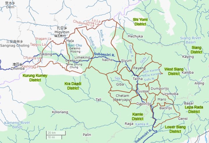
📷 Image: Wikimedia Commons / DescriptionUpper Subansiri district.png
This map
Defence
Taksing, Arunachal grapples with China border tension, bad roads and map disputes
✍️ India Today
🗓 29 Oct 2026, 03:20 AM
👁 11
The remote border village of Taksing in Arunachal Pradesh is confronting three interlinked problems – frequent Chinese incursions, inadequate road infrastructure and disputes over its representation on official maps.
Taksing, a small settlement perched on the banks of the Subansiri River in Arunachal Pradesh’s Upper Subansiri district, lies just a few kilometres from the Line of Actual Control with China. In recent months, Indian security forces have reported repeated Chinese patrols crossing the de‑facto border, heightening tensions in a region already sensitive to geopolitical shifts.
The village’s isolation is compounded by a chronic lack of road connectivity. The only motorable link, a narrow forest track, remains vulnerable to landslides and monsoon wash‑outs, forcing residents and troops to rely on footpaths or air‑lift for essential supplies. Officials say the poor infrastructure hampers rapid deployment of forces and limits economic opportunities for the local tribal population.
Adding to the strategic dilemma is a recurring dispute over cartographic representation. Several Indian government maps have omitted or mis‑placed Taksing, prompting objections from local leaders who argue that such errors undermine territorial claims and affect development planning. The mapping issue has become a symbolic flashpoint in the broader border narrative.
New Delhi has pledged to accelerate road‑building projects under the Border Roads Organisation and to review official cartographic data to ensure accurate depiction of frontier settlements. However, analysts caution that tangible improvements will take time, leaving Taksing caught between geopolitical pressure, infrastructural neglect, and bureaucratic oversights.